
Every spring, water managers across the western United States hold their breath. They watch the snowpack, check the streamflow gauges, and run their runoff models. A decade ago, those models felt reliable. Today, they feel like guesses. The reason is simple: temperature changes are rewriting the rules of how snow accumulates and melts.
You don’t need to be a hydrologist to see the effects. Ski resorts patch together thin base layers. Farmers get nervous when irrigation allocations get cut. Cities impose watering restrictions. The common thread is snowpack — the seasonal reservoir that stores winter precipitation and releases it slowly through spring and summer. When temperatures shift, that reservoir behaves differently.
EDTM
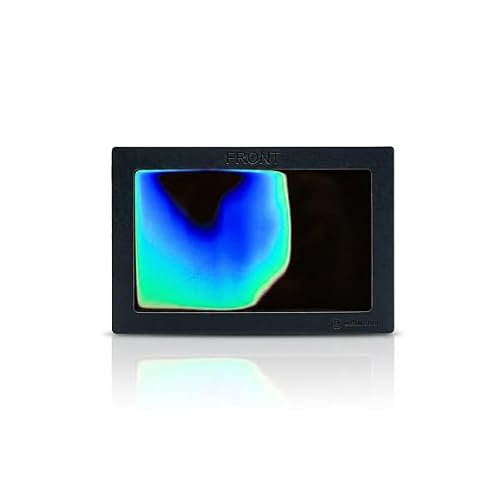
EDTM HS2050 HEAT-SHEET® Color-Changing Temperature Demo Card,…
- The HEAT-SHEET Temperature Demonstration Card: The HEAT-SHEET Temperature Demo Card provides an easy, economical way to show custo…
- Simple demonstration. Instant visual impact. A valuable addition to any sales presentation: Customers understand what they can see…
- Why Professionals Rely on It: The HEAT-SHEET Card uses a dynamic color-changing effect to visually compare energy-efficient and en…
This article digs into the mechanics of that shift. You’ll learn what happens when snowpack gets warmer, why high elevations aren’t safe, and how different types of snow droughts affect water supplies. You’ll also get a practical framework for understanding what a 1°F versus 3°F increase actually means on the ground.
If you work in water, energy, or recreation, you’ve probably had to explain these concepts to someone. A temperature demo card from EDTM can help make the invisible visible. It changes color when exposed to heat, which makes it useful for showing how different materials absorb or block radiant energy. It’s a simple tool, but it translates the physics of heat transfer into something you can see with your own eyes.

The Invisible Crisis: Why Snowpack is More Than Just a Winter Aesthetic
Snowpack is often described as a frozen reservoir. That metaphor undersells it. A healthy snowpack does more than store water — it manages the timing of that water’s release. Melt happens gradually, feeding streams through the dry summer months. When temperatures rise, that timing gets compressed.
Consider the numbers. The Sierra Nevada snowpack historically holds about 15 million acre-feet of water. That’s roughly 30% of California’s annual water supply. In the Rockies, snowmelt contributes 60-80% of annual streamflow in many basins. The Alps supply similar proportions to rivers like the Rhine and the Rhône. When snowpack underperforms, the consequences ripple outward.
The key metric hydrologists track is snow water equivalent (SWE). SWE measures how much water is contained in the snowpack, regardless of its depth. A snowpack that’s 60 inches deep with 20% density has an SWE of 12 inches. The same depth with 40% density has an SWE of 24 inches. That difference matters enormously for spring runoff predictions.
Temperature changes affect SWE in two ways. First, warmer air shifts precipitation from snow to rain, reducing the total snow accumulation. Second, warmer temperatures accelerate melt and increase snowpack density, which changes how quickly water runs off. Both effects are happening simultaneously, and both are measurable.
The Thermodynamics of Snow: How a Few Degrees Reshape the Snowpack
Let’s get specific about what temperature does to snow. The most obvious effect is phase change. Snow forms when temperatures are below freezing (32°F/0°C) at the surface and in the atmosphere. But the threshold isn’t binary. Precipitation can fall as snow at temperatures slightly above freezing if the lower atmosphere is cold enough. Conversely, rain can fall at temperatures just below freezing if the snow melts on the way down.
The practical threshold for most mountain basins is around 2°C (35.6°F). Above that, precipitation increasingly falls as rain. This is called the precipitation phase boundary. As temperatures warm, this boundary moves upward in elevation. A basin that historically received 70% of its winter precipitation as snow might now receive only 50%.
The Shift from Snow to Rain
The shift from snow to rain isn’t gradual in terms of impact. It’s a cliff. A basin at 6,000 feet might lose 20% of its snowpack with a 1°C temperature increase. The same basin could lose 50% with a 2°C increase. The relationship is nonlinear because the precipitation phase boundary crosses the basin’s elevation range.
Rain falls and runs off immediately. Snow lingers and releases water slowly. When rain replaces snow, the peak streamflow shifts earlier in the year. Instead of a steady release through June and July, you get a sharp spike in April. That spike can cause flooding, but more importantly, it means less water available during the late summer when demand is highest.
This isn’t a hypothetical. The Pacific Northwest has seen its spring snowmelt advance by 20-30 days over the past 50 years. The Colorado Rockies have seen similar shifts. Earlier melt means longer dry seasons, which stresses both ecosystems and infrastructure.
The Density Dilemma: Warmer Snow is Heavier Snow
Warmer temperatures don’t just change precipitation phase. They also change the snowpack itself. Fresh snow has a density of about 100 kg/m³. After a few days, that settles to around 200-300 kg/m³. By mid-spring, a typical mountain snowpack reaches densities of 400-500 kg/m³. Warmer temperatures accelerate this densification process.
Why does density matter? Denser snow holds more water per unit of depth, but it also melts faster. Dense snow conducts heat more efficiently than light, fluffy snow. A warm rain event on a dense snowpack can trigger rapid melt because the heat transfers quickly through the snow column. This is why you’ll see dramatic runoff events in late spring that seem disproportionate to the actual air temperature.
There’s another consequence. Denser snow compresses the layers beneath it, which can reduce the snowpack’s insulating properties. This affects soil temperatures and can change the timing of when the ground thaws. For ecosystems adapted to a specific melt schedule, even a two-week shift can disrupt the entire growing season.
The Elevation Myth: Why High Peaks Aren’t Safe Havens
There’s a common assumption that high-elevation snowpack is safe from warming. The logic seems sound: it’s colder up there, so snow will persist. The reality is more complicated.
High-elevation snowpack is indeed colder, but it’s not isolated from atmospheric changes. The rain-snow line is shifting upward as temperatures rise. A basin that historically got snow at 8,000 feet might now get rain at 9,000 feet. At elevations above 10,000 feet, the effect is less pronounced, but it’s still present.
The bigger issue is that high-elevation snowpack melts faster when the surrounding air is warmer. Even if precipitation remains snow, the snow doesn’t last as long. A study from Dartmouth found that spring snowpack in the Northern Hemisphere has declined by about 10% per decade since the 1980s, with the steepest losses at mid-elevations. The Dartmouth research shows that human-caused warming is the primary driver, not natural variability.
The elevation refuge myth persists because high peaks still hold snow late into summer. But the snowline is creeping upward. What was once a 9,000-foot snowline is now at 10,000 feet. The areas that remain snow-covered are shrinking, and the water they release is coming earlier.
Warm Snow Drought vs. Dry Snow Drought: A Critical Distinction
Water managers use the term “snow drought” to describe years when snowpack is below average. But not all snow droughts are the same. The distinction matters for how you plan and respond.
A dry snow drought happens when precipitation is below average. The winter was simply dry. There’s no snow because there was no moisture. This is straightforward to understand and relatively easy to forecast.
A warm snow drought happens when precipitation is normal or even above average, but temperatures are warm enough that precipitation falls as rain or the snow melts quickly. The water might be there, but it’s not stored as snow. This type of drought is trickier because the total precipitation might look normal on paper, yet the snowpack is still deficient.
The practical difference is in the runoff timing. In a dry snow drought, there’s simply less water. In a warm snow drought, the water arrives earlier and in a less predictable pattern. Warm snow droughts also tend to be more common than dry snow droughts in a warming climate, which complicates long-term water resource planning.
The Ripple Effect: From Ski Resorts to City Faucets
The impacts of reduced snowpack extend far beyond mountain recreation. They reach into agriculture, energy production, and municipal water supplies. Each sector responds differently, but they all face the same underlying problem: less water stored as snow, released at the wrong time.
Water Supply Forecasting in a Warmer World
Forecasting spring runoff is a core function of water management. Agencies like the Natural Resources Conservation Service (NRCS) measure snowpack throughout the winter and use those measurements to predict streamflow for the coming months. These forecasts drive decisions about reservoir releases, flood control, and irrigation allocations.
Warming temperatures make these forecasts less reliable. The relationship between snowpack and streamflow is changing. A given snowpack today produces less runoff than the same snowpack did 30 years ago, because more of the melt is absorbed by dry soils or lost to evaporation. Forecasters are having to adjust their models, but the adjustments are lagging behind the observed changes.
This unreliability has real costs. Reservoirs held back too much water in anticipation of snowmelt might not have enough capacity for a sudden warm storm. Conversely, reservoirs released too early might not have enough water for late-summer demands. Both scenarios create conflicts between water users.
Agricultural and Hydropower Strain
Farmers in the western United States rely on snowpack for irrigation water. The timing of snowmelt aligns with the growing season, which is why the system works. Earlier melt disrupts that alignment. Crops need water in July and August, but if the snow is gone by May, the water is already downstream.
Hydropower operators face a similar problem. They depend on a steady release of water throughout the year. Early melt means more generation in spring and less in summer, when electricity demand peaks for air conditioning. This forces operators to import power from other regions or rely on natural gas peaker plants, which are more expensive and emit more greenhouse gases.
The bottom line is that reduced snowpack acts like a tax on the entire water system. It doesn’t make the system fail outright, but it makes everything slightly harder and more expensive.
The Dust Factor: How Pollution Accelerates Melt
Temperature isn’t the only variable driving snowpack decline. Dust and soot play a significant role, and they’re often overlooked.
Clean snow reflects about 80-90% of incoming solar radiation. This is called the albedo effect. When dust or soot lands on the snowpack, it darkens the surface, reducing albedo. The dark particles absorb more sunlight, which warms the snow and accelerates melting.
The effect is measurable. Research from the Colorado River Basin shows that dust deposition shortens the snow season by about 30 days and reduces peak runoff by about 5%. The dust comes from disturbed soils in the desert Southwest, often from grazing, agriculture, and development. As those areas dry out, more dust is available to be transported to the mountains.
This creates a feedback loop. Warmer temperatures dry out the soil, which produces more dust, which darkens the snow, which causes it to melt faster, which exposes more soil. It’s a compounding problem that temperature alone doesn’t capture.
Regional Breakdown: A Non-Uniform Future
Snowpack responds differently to warming depending on the region. The Sierra Nevada, the Rockies, and the Alps are all mountain ranges, but their climates and elevations produce different outcomes.
The Sierra Nevada is particularly vulnerable because it has a relatively low average elevation and a strong rain-snow transition zone. A 1°C increase in temperature historically reduced April 1 snowpack by about 20% in the Sierra. The cascading effect is severe because California depends on this snowpack for a large share of its water supply.
The Rockies are somewhat more resilient due to higher elevations and colder temperatures. But the lower-elevation basins, especially those in the southern Rockies, are losing snowpack at rates similar to the Sierra. The northern Rockies are holding up better, though even there, the snow season is shortening.
The Alps sit in a different climate regime, with more maritime influence. They’ve seen significant snowpack declines at elevations below 2,000 meters (about 6,500 feet). Above that, the trend is less clear, but the overall pattern is consistent: lower elevations are losing snow, and the snowline is moving up.
| Region | Primary Vulnerability | Observed Trend | Key Concern |
|---|---|---|---|
| Sierra Nevada | Low elevation, strong rain-snow transition | 20% snowpack loss per 1°C warming | California water supply, flood risk |
| Southern Rockies | Dry climate, high variability | Steep declines in lower basins | Colorado River flow, agriculture |
| Northern Rockies | Cold climate, but warming fast | Shortening snow season | Late-summer streamflow |
| Alps | Maritime influence, mixed elevations | Declines below 2,000m | Ski tourism, hydropower |
Adaptation Playbook: Managing the New Snowpack Reality
You can’t stop the warming, but you can adapt to the changing snowpack. The strategies differ by sector, but they share a common theme: build flexibility into the system.
Ski resorts are investing in snowmaking, but that’s a short-term fix. Snowmaking requires water and energy, both of which become scarcer in a warming world. More durable strategies include diversifying revenue streams (summer activities, conferences) and shifting operations to higher elevations where snow is more reliable.
Farmers are changing crop mixes and irrigation timing. Some are investing in more efficient drip irrigation, which delivers water directly to roots and reduces evaporative losses. Others are shifting to less water-intensive crops entirely. The challenge is that these changes require capital, and many farmers are operating on thin margins.
Municipal water utilities are building new storage infrastructure, including groundwater recharge projects. The idea is to capture early runoff and store it underground, where it doesn’t evaporate. This is a promising approach, but it requires suitable geology and significant investment.
One practical step for any water-dependent business is to improve its monitoring. Tracking snowpack levels, streamflow, and soil moisture in real time allows for faster adjustments. The seasonal temperature changes are predictable, but their impacts on snowpack are not. Better data helps close that gap.
Another useful reference is understanding how daily temperature swings affect the freeze-thaw cycles that shape snowpack structure. These cycles are becoming more extreme, which accelerates the conversion of snow to ice and reduces its water-holding capacity.
Finally, it’s worth understanding how seasonality drives temperature changes in the first place. The same solar geometry that drives winter and summer also drives the elevation gradients that control where snow falls and melts.
What This Means for the Next Decade
The snowpack of the 2030s will not look like the snowpack of the 1990s. The trends are clear: less snow at lower elevations, earlier melt, and more variability from year to year. The uncertainty is in the details, not the direction.
If you’re a water user, the message is to plan for less water stored as snow. If you’re a skier, expect shorter seasons and more reliance on snowmaking. If you’re a land manager, prepare for more dust and its compounding effects.
The tools to understand these changes are getting better. Remote sensing, climate models, and on-the-ground measurements are all improving. But the fundamental physics hasn’t changed. Warm air holds more moisture, melts snow faster, and shifts precipitation from solid to liquid. Every degree of warming matters.
- Every 1°C of warming shifts the rain-snow line upward by roughly 150 meters (about 500 feet).
- Warm snow droughts are becoming more common than dry snow droughts, complicating water forecasts.
- Dust and soot can shorten the snow season by up to a month, independent of temperature.
- High-elevation snowpack is not immune to warming; it’s just slower to respond.
- Earlier snowmelt shifts peak streamflow earlier, creating a mismatch between supply and demand.
- Adaptation requires flexibility: diversified revenue, efficient irrigation, and better monitoring.
- Snowpack declines are regional, not uniform — the Sierra and southern Rockies are losing snow faster than the northern Rockies or the Alps.

I am a mechanical engineer and love doing research on different home and outdoor heating options. When I am not working, I love spending time with my family and friends. I also enjoy blogging about my findings and helping others to find the best heating options for their needs.
Related guides
How Rising Temperatures Intensify Fire Seasons Worldwide
You watch the evening news in July and see smoke plumes from a fire that started 200 miles…

How Temperature Changes Accelerate Wetland Degradation
You pull up to a marsh you’ve known since childhood. The waterline is lower. Cracks spiderweb across exposed…

How Temperature Drastically Changes Insect Behavior: A Predictive Guide
You've seen it: a warm spring day and suddenly aphids are everywhere. A cold snap and they vanish.…