

You watch the news reel of another nor’easter chewing through a dune line, and the narrator says climate change is making it worse. That feels true, but vague. What’s the actual chain of events between a warmer planet and your favorite beach losing twenty feet of sand in one winter? It’s not just bigger storms, though those matter. The heat itself is doing physical work on the coastline, and the mechanisms are specific, measurable, and frankly more interesting than the usual soundbite.
This article walks through the physics of heat-driven erosion, the regional numbers that show how fast different coasts are losing ground, and the economic damage that follows. You’ll also get a practical checklist to assess your own property’s vulnerability. By the end, you should be able to explain the feedback loops involved and tell a hard structure from a nature-based solution with actual reasoning.

If you want a deeper technical reference on sediment transport and shoreline response, the Handbook of Coastal Processes and Erosion from CRC Press covers the engineering and geological frameworks in detail. It’s a solid desk reference for planners and serious property owners, though it’s not a light read.
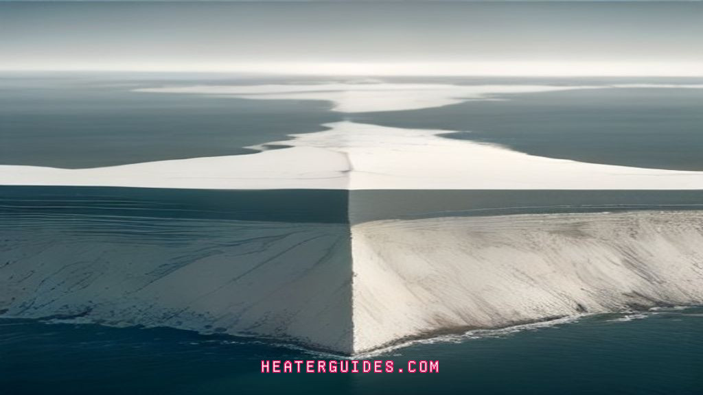
The Direct Link: How Heat Fuels Erosion

Rising temperatures don’t just melt ice; they change the energy balance of the entire coastal system. The most direct pathway is thermal expansion. As the ocean warms, water molecules take up more space. That expansion alone has contributed roughly 40% of the observed global sea level rise over the past century, with meltwater from glaciers and ice sheets accounting for the rest. Every millimeter of sea level rise means waves break closer to the dune toe, and the erosion zone migrates landward.
But the temperature link goes deeper than sea level. Warmer air holds more moisture, which fuels more intense precipitation events. That means more runoff carrying sediment off the land and into the nearshore zone, where it can be swept away by longshore currents rather than building beaches. Warmer oceans also strengthen hurricanes and mid-latitude cyclones. A storm that might have been a Category 2 fifty years ago now often arrives as a Category 4, with proportionally higher storm surge and wave energy.
The Wave Energy Multiplier
Wave energy scales with the square of wave height. A storm that produces ten-foot waves carries four times the erosive power of a five-foot wave. When you combine higher sea levels with stronger winds, the effective wave attack on the shoreline increases non-linearly. This isn’t a linear additive problem; it’s a multiplier. A one-foot rise in sea level can effectively double the erosion rate on a sandy coast because waves that previously broke offshore now crash directly against the dune face.
This is why you see erosion hotspots appear suddenly after a single storm event. The system was already primed by thermal expansion and higher baseline water levels. The storm just delivered the final blow.
Regional Hotspots: Where Erosion is Accelerating Fastest
No single number describes coastal erosion in the US, because the rates vary wildly by region. The Gulf Coast is losing ground fastest, with some sections of Louisiana losing over 30 feet per year. That’s not a typo. The Mississippi River Delta is subsiding naturally, but rising sea levels and reduced sediment supply from upstream dams have turned natural subsidence into a crisis. In Texas, Galveston Island loses an average of 4 to 6 feet per year, with storm years pushing that to 20 feet in a single event.
The Atlantic Coast is a mixed bag. The Outer Banks of North Carolina lose about 3 to 4 feet per year on average, but the rate has doubled in the last decade. Cape Cod in Massachusetts loses roughly 1 to 2 feet per year, though the glacial bluffs on the ocean side can lose 5 feet in a single winter storm. The Pacific Coast is more variable because of rocky headlands, but the sandy stretches like Ocean Beach in San Francisco lose 2 to 3 feet per year, and the erosion is accelerating as wave heights in the Pacific increase.
Here’s a comparison table that puts these numbers side by side, based on USGS and state coastal management data:
| Region | Average Erosion Rate (ft/year) | Primary Driver | Storm Event Rate (ft/event) |
|---|---|---|---|
| Louisiana (Gulf) | 30+ | Subsidence + sea level rise | 50+ |
| Galveston Island, TX | 4-6 | Thermal expansion + storms | 20 |
| Outer Banks, NC | 3-4 | Nor’easters + sea level rise | 15 |
| Cape Cod, MA | 1-2 | Winter storms + bluffs | 5 |
| Ocean Beach, CA | 2-3 | Increased Pacific wave energy | 10 |
These aren’t just academic numbers. They translate directly into property loss, infrastructure damage, and the difficult decision of whether to armor the coast or retreat.
The Hidden Economic Toll of a Shrinking Shoreline
The economic damage from accelerated erosion is often underestimated because the costs are spread across different sectors and timeframes. Property value loss is the most visible. A beachfront home that loses its beach loses 15-25% of its value, even if the structure itself is untouched. On the East Coast, that’s a six-figure hit for many homeowners. The National Flood Insurance Program has paid out over $1 billion in erosion-related claims in the last decade, and that number is climbing.
Tourism revenue takes a quieter hit. A beach that narrows from 100 feet to 30 feet still functions, but it feels crowded and less attractive. Coastal communities from Florida to Maine have reported 5-10% declines in tourism revenue following erosion events that narrow the dry sand area. That translates to lost jobs in hospitality, retail, and recreation sectors that depend on beach access.
Insurance premiums are the sleeper cost. In high-risk coastal zones, flood insurance premiums have doubled in some ZIP codes over the past five years. Property insurers are also pulling out of coastal markets entirely, leaving homeowners with fewer options and higher deductibles. This creates a feedback loop of its own: as insurance costs rise, property values drop further, shrinking the tax base that funds shoreline protection measures.
There’s also the direct cost of intervention. Beach nourishment projects, which pump sand from offshore or borrow sites onto the beach, cost $10-30 million per mile depending on the location and sand quality. These projects last 5-10 years before needing repeat, which makes them a recurring expense rather than a one-time fix.
The Erosion Feedback Loop: Why It Gets Worse Faster
Here’s the part that keeps coastal engineers up at night. Eroded sediment doesn’t just disappear. It goes into the nearshore zone, where it changes the underwater slope. A gentler offshore slope means waves break further out and lose energy before hitting the beach. But when erosion removes the beach and dune, the offshore profile often steepens. Steeper profiles mean waves break closer to shore and with more energy, which increases erosion further. It’s a self-reinforcing cycle.
There’s another loop involving the sediment itself. As fine sand and silt are eroded and suspended in the water column, they reduce light penetration. That kills seagrass beds and nearshore vegetation that once stabilized the seafloor. Without that vegetation, the sediment is more mobile, and erosion accelerates. The loss of habitat also reduces fish populations, which hurts commercial fishing communities that are already struggling with changing ocean temperatures.
This is why you can’t just look at sea level rise in isolation. The rate of erosion on a given coast depends on the local sediment budget, the offshore slope, and the presence of stabilizing vegetation. Two coasts with identical sea level rise can have vastly different erosion rates based on these factors.
Arctic Extremes: The Permafrost Erosion Crisis
The Arctic coast is where the temperature-erosion link is most dramatic. Permafrost holds the coastline together, but it’s thawing at an alarming rate. Along the Alaskan Beaufort Sea coast, erosion rates have increased from about 20 feet per year in the 1990s to over 60 feet per year in the last decade. Some locations have seen single storms remove 100 feet of coastline in a few days.
The mechanism is different from sandy coasts. When permafrost thaws, the ice that binds the soil and gravel melts, leaving a slurry that waves wash away easily. The warming ocean also extends the ice-free season, meaning waves can attack the coast for months rather than weeks. The loss isn’t just land; it’s cultural and infrastructural. Entire villages like Shishmaref and Kivalina are planning relocation because the land beneath them is literally disappearing.
This Arctic erosion also releases ancient organic carbon that has been frozen for millennia. That carbon converts to greenhouse gas emissions, which accelerates warming, which thaws more permafrost. It’s a climate feedback loop that operates on a timescale that’s hard to wrap your head around, but it’s happening right now.
Adaptation vs. Mitigation: What Actually Works
The debate between hardening the shoreline and using nature-based solutions is not settled, and it shouldn’t be. Each approach has trade-offs, and the right choice depends on the specific site, the budget, and the community’s long-term goals.
Hard Structures vs. Nature-Based Solutions
Hard structures like seawalls, revetments, and groins have been the default for a century. They work in the short term, but they have a well-documented downside. A seawall reflects wave energy back into the nearshore zone, which scours the beach in front of it and often increases erosion on adjacent properties. This is called the “end effect” or “flanking,” and it’s a classic case of solving your problem by making your neighbor’s worse. The USGS has documented cases where seawall construction led to 2-3 times faster erosion on neighboring unprotected beaches.
Nature-based solutions, like living shorelines and dune restoration, are more resilient but slower to establish. A restored dune with native vegetation can absorb wave energy and trap wind-blown sand, building elevation over time. Living shorelines use oyster reefs and marsh grasses to dissipate wave energy before it reaches the upland. These approaches don’t provide the same immediate protection as a seawall, and they require maintenance and monitoring. But they don’t create the same negative downstream effects, and they provide habitat and water quality benefits.
There’s also the option of managed retreat, which is politically difficult but increasingly necessary. Buying out properties in the highest-risk zones and allowing the coast to migrate landward is the only strategy that doesn’t fight nature. It’s expensive upfront, but it avoids the recurring costs of nourishment and the inevitable failure of hard structures under rising seas.
A Homeowner’s Vulnerability Checklist
If you live near a coast, here’s a practical way to assess your exposure today. This isn’t a substitute for a professional engineering assessment, but it will give you a clear sense of your risk profile.
- Measure the dune height: If your dune is less than 10 feet above high tide, a moderate storm can overtop it. If it’s less than 5 feet, even a high tide combined with wind can cause flooding.
- Check the erosion rate: Look up your county’s coastal erosion rate from the USGS or state geological survey. If it’s more than 2 feet per year, your property is likely to be affected within a typical 30-year mortgage.
- Evaluate the setback: How far is your structure from the vegetation line? If it’s less than 50 feet, you’re in the active erosion zone. If it’s less than 25 feet, you’re at imminent risk.
- Look at the offshore slope: A steep drop-off near the beach means waves will hit with more energy. If you can walk out 100 yards and the water is still waist-deep, the slope is gentle, which is better.
- Check for vegetation: Healthy dune grass and shrubs indicate a stable system. Bare sand or eroded scarps mean the dune is already failing.
- Review your insurance: Does your policy cover erosion, or only storm surge? Many standard policies exclude gradual erosion, which is the most common form of loss.
- Ask about the local plan: Is your town considering beach nourishment, a seawall, or a retreat program? Your property’s future depends on the collective decision, not just your individual actions.
Working through this list takes an afternoon, but it can save you from a catastrophic surprise. The historical record of coastal erosion shows that the most costly mistakes happen when people assume the shoreline is static.
The Future of Our Coasts: A Call to Action
Rising temperatures are not a distant threat; they are actively reshaping coastlines right now. The polar regions are losing ice at rates that were considered worst-case scenarios just a decade ago, and the resulting sea level rise is compounding local erosion factors everywhere.
The good news is that the tools to manage this exist. We know how to build resilient shorelines, we have the data to identify the highest-risk zones, and we have the economic models to justify investment in protection. What’s lacking is the political will to make hard choices before the next big storm forces them.
If you own coastal property, start with the checklist above. If you’re a planner or engineer, push for nature-based solutions where they make sense and be honest about the limits of hard structures. If you’re a voter, ask candidates what their coastal adaptation plan is. The coastline you save will be your own.
Also worth understanding is how seasonal temperature shifts interact with storm frequency, since the timing of warming matters as much as the magnitude.
How much sea level rise is attributed to thermal expansion?
Roughly 40% of the observed global sea level rise over the past century comes from thermal expansion. The other 60% comes from melting glaciers and ice sheets. The ratio shifts over time, but thermal expansion is always a significant component because the ocean absorbs over 90% of the excess heat trapped by greenhouse gas emissions.
Can beach nourishment keep up with accelerated erosion?
Sometimes, but it’s a treadmill. A typical nourishment project lasts 5-10 years before the sand is gone. As erosion rates accelerate, the interval between projects shortens, and the cost per mile rises. In high-energy environments like the Outer Banks, nourishment is becoming a permanent annual expense rather than a periodic fix. It works best on coasts with a stable sediment supply, which is increasingly rare.
What’s the difference between erosion and shoreline retreat?
Erosion is the physical removal of sediment by waves, currents, and wind. Shoreline retreat is the landward movement of the high-water line over time. Erosion causes retreat, but retreat can also happen due to sea level rise alone, even without net sediment loss. A coast can retreat simply because the water is higher, not because the sand is gone. This distinction matters for management: reducing erosion doesn’t stop retreat if sea level is rising.
Does building a seawall always make things worse?
Not always, but it often does. A well-designed seawall protects the property behind it, but it reflects wave energy that increases turbulence and scour at its base. That leads to beach loss in front of the wall and often accelerates erosion on adjacent properties. In areas with high wave energy, seawalls can actually fail catastrophically when the foundation is undermined. They’re a defensible last resort for protecting critical infrastructure, but they’re a poor choice for residential coastlines with room to retreat.
How quickly can permafrost coastlines erode?
Fast enough to be almost unbelievable. The Alaskan Beaufort Sea coast has seen erosion rates of 60 feet per year in the last decade, with individual storms removing 100 feet in a few days. This happens because thawed permafrost is essentially a wet slurry with no structural strength. The warming ocean also extends the ice-free season, giving waves more time to attack. These rates are an order of magnitude higher than sandy coasts and are accelerating as the Arctic warms faster than the global average.
What You Can Do With This Information
- Check your local erosion rate before buying coastal property; 2 feet per year is a red flag.
- Support nature-based solutions like dune restoration and living shorelines over hard structures where feasible.
- Review your insurance policy for erosion coverage; gradual erosion is often excluded.
- Participate in local coastal management planning; your voice matters in the decision between nourishment and retreat.
- Understand that thermal expansion is a permanent, non-reversible component of sea level rise; adaptation is necessary, not optional.
- Monitor storm surge forecasts and evacuate when advised; erosion makes surge penetration worse.
- Push for national policies that reduce greenhouse gas emissions, since that’s the only long-term brake on the erosion feedback loops described here.

HeaterGuides covers home heating, water heating and HVAC: how the equipment works, what it costs to run, and how to use it safely.
